

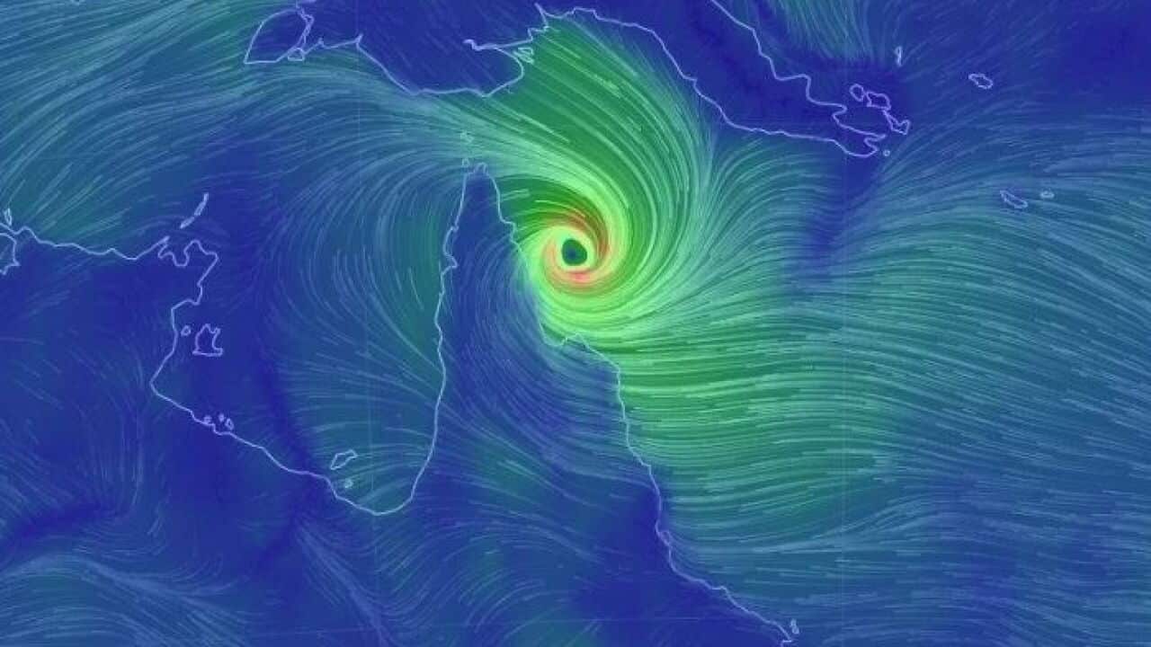
Cyclone Trevor has intensified to a severe category three storm and is expected to soon make landfall on the far north Queensland coast.
The weather bureau forecasts the storm, which is moving at a rate of about seven kilometres per hour, to hit about 4pm on Tuesday with wind gusts of up to 165km/h.
"The cyclone will continue moving in a west-southwest direction and is expected to cross the coast south of Lockhart River this evening," the Bureau of Meteorology said.
Warnings have been issued for Orford Ness to Cape Flattery, extending across the Cape York Peninsula to Pormpuraaw and Mapoon, including Weipa and Coen.
Residents are being told to prepare for the cyclone by securing boats and property with damaging winds and heavy rainfall expected over the next few days.
Bloomfield River State School has been closed, and the Queensland Department of Education has urged parents to be careful around floodwater when dropping off or collecting children.
The storm is expected to weaken to a category one system as it crosses the Cape York Peninsula before re-intensifying as it crosses the Gulf of Carpentaria on Wednesday afternoon.