In addition to locating the aircraft, the underwater search aims to map the MH370 debris field in order to identify and prioritise the recovery of specific aircraft components, including flight recorders, which will assist with the Malaysian investigation.
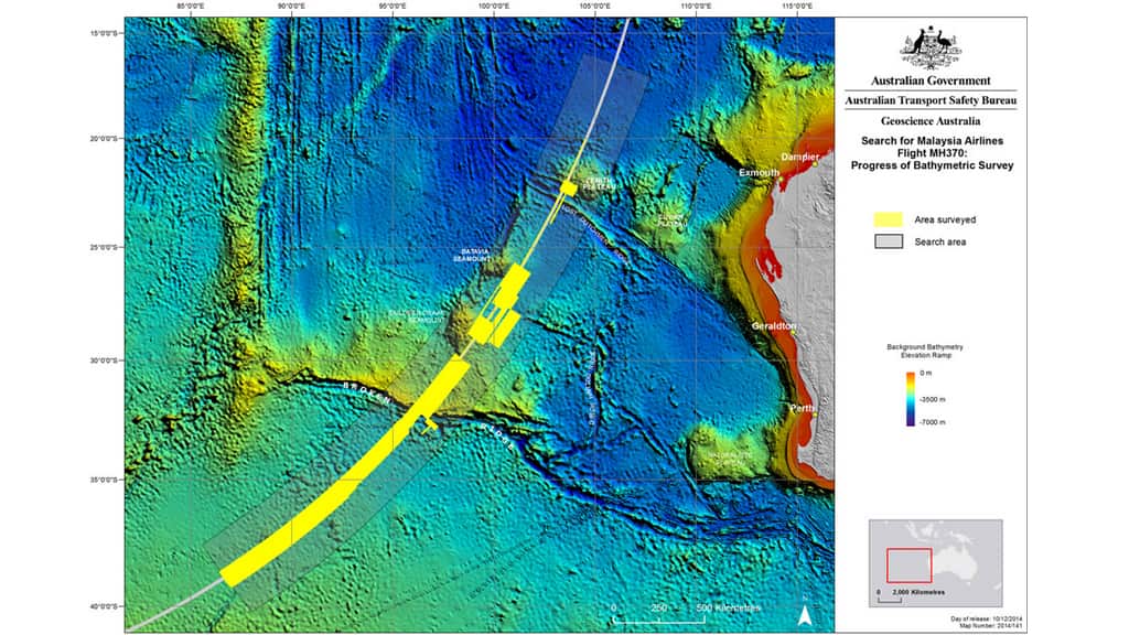
The Fugro Equator - a dedicated survey vessel that was contracted to conduct a bathymetric survey in the southern Indian Ocean for the purpose of searching for Malaysia Airlines Flight MH370 - has continued its survey work. To date, around 200,000 square kilometres of the search area have been surveyed.
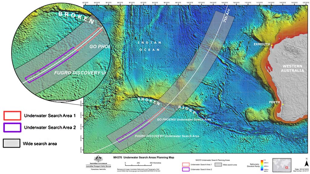
The equipment used on three vessels - the Fugro Equator, Fugro Discovery and GO Phoenix - has, according to the JACC's MH370 Operational Search Update, provided "extraordinary data".
News that makes sense
Your trusted source for staying up-to-date with the world around you. Get free daily news updates and analysis, straight to your inbox.
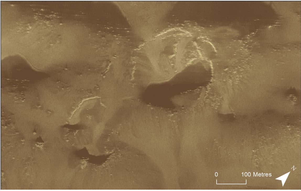
A synthetic aperture sonar acoustic image of the seafloor gathered by GO Phoenix is indicative of the resolution and quality of the data and that it is revealing important detail of the seafloor.