

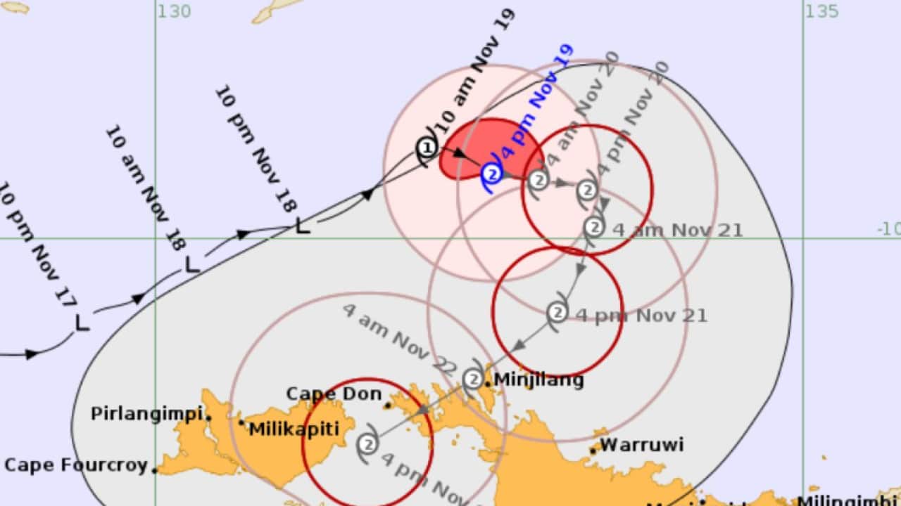
Tropical Cyclone Fina has formed off the Northern Territory and developed into a category two system late on Wednesday, but may still intensify as it tracks toward Darwin.
It is forecast to make landfall early on Saturday, marking the earliest time of the year a cyclone has hit the NT since 1970.
Darwin was likely to be impacted based on how the system was tracking, Bureau of Meteorology forecaster Jude Scott said on Wednesday.
"There will be heavy rain and windy days ahead and it's possible that Saturday will be the main day when the cyclone impacts the Darwin area," she said.
Scott could not rule out the cyclone intensifying into a category three system.
News that makes sense
Your trusted source for staying up-to-date with the world around you. Get free daily news updates and analysis, straight to your inbox.
"These systems move erratically and there is always a possibility that it may intensify into a category three system as it makes its way toward the coast," she said.
Darwin residents began stocking up on bottled water as they prepared to bunker down ahead of the cyclone, leaving empty supermarket shelves.
The NT's emergency operations centre was activated on Wednesday and regional emergency committees stood ready, authorities said.
Extra police were sent to the Tiwi Islands and other remote communities to ensure shelters were ready and they had enough food, water and back-up batteries.
Volunteer emergency response units had been readied in recent days, NT emergency services chief officer Wayne Snell said.
People have been urged to ensure they have a cyclone plan and shelter at home.
"The safest advice we can give you is if your house is built to code then stay in your home," Snell said.
Residents should also ensure their emergency kits were ready and stay in touch with emergency websites and media.
Cyclone Fina on Wednesday was moving northeast but was expected to do a U-turn on Thursday and track back towards the NT coast and the Tiwi Islands.
After crossing the Cobourg Peninsula it is expected to move down into the Van Diemen Gulf then cross the coast again around the Darwin area on Saturday.
Residents of Darwin and surrounds are likely to see showers and storms intensify on Friday night, with winds ramping up into Saturday and storm surges hitting coastal areas facing the cyclone directly.
Category two systems can produce wind gusts of 125km/h to 164km/h and cause minor house damage and significant crop, sign, tree and caravan damage, along with power cuts.
Darwin has not experienced a cyclone since category two system Marcus cut power to nearly 29,000 properties in March 2018.
Cyclone Tracey was the most devastating system to hit Darwin, killing 66 people after the city was destroyed on Christmas Day in 1974.
For the latest from SBS News, download our app and subscribe to our newsletter.
