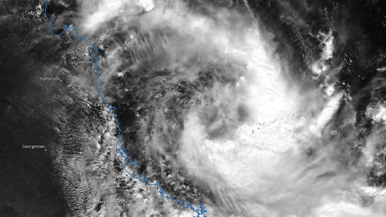
Tropical Cyclone Iris remains a category one after it failed to weaken to a low-pressure system overnight, but the erratic storm could linger along Queensland's coast for days.
Iris has battered the coastline with 100km/h winds and heavy rain this week.
Residents in the Whitsunday region were urged to remain indoors on Wednesday as the then-category two system passed over the area.
It fizzled into a category one in the afternoon and was expected to weaken further overnight, but remained steady as it lingered off the coast.
Bureau of Meteorology forecaster Jim Richardson said Iris should weaken to a low-pressure system on Thursday.
News that makes sense
Your trusted source for staying up-to-date with the world around you. Get free daily news updates and analysis, straight to your inbox.
"She's tracking very slowly south," he told AAP.
The cyclone is located 295km east-northeast Hamilton Island and 310km northeast of Mackay.
It is moving east-southeast at about 6km/hr but the BoM predicts it will turn and track north-west into tropical waters in the next 24 hours, where there's the potential it could reform into a cyclone.
Cyclone warnings are no longer in place onshore, but gale-force winds are expected to continue about the central and southern Great Barrier Reef on Thursday.
