In brief
- The UN has voted in favour of adopting a new world map.
- The new map updates the centuries-old Mercator projection to a "more accurate" scale.
The United Nations General Assembly voted Saturday to back a resolution spearheaded by several African countries to adopt a map that makes their continent bigger while shrinking North America and Europe.
Aimed at "a more accurate representation" of continental landmasses, the resolution was supported by 164 countries while the United States voted against it and six other states abstained.
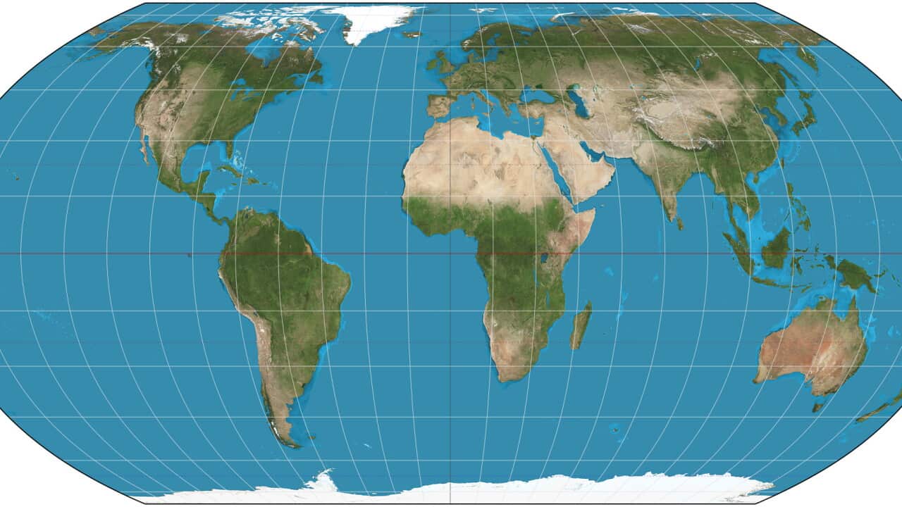
The new map — known as the Equal Earth cartographic projection — "is a relevant option for improving the accuracy of the cartographic representation of the world," the resolution said.
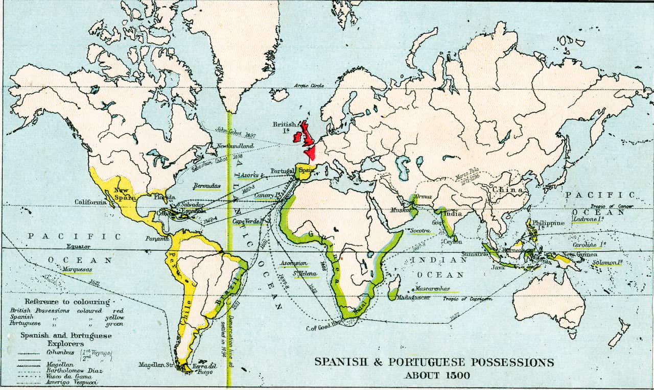
It urges member states to adopt the new map in place of the traditional Mercator projection, which was designed for maritime navigation by Flemish cartographer Gerardus Mercator in 1569.
Foreign Minister Robert Dussey of Togo, which drove the resolution, said maps "guide education, nourish the imagination, and influence collective perceptions."
News that makes sense
Your trusted source for staying up-to-date with the world around you. Get free daily news updates and analysis, straight to your inbox.
"They are therefore never neutral, when they present a distorted image of our planet, they risk perpetuating inaccurate representation that are passed down through generation."
The United States, however, slammed the resolution, saying such moves are "the reason this institution is losing its credibility."
"Instead of focusing on genuine problems ... this body is debating map projects from the 16th century and their role in promoting reparations and cognitive justice," US representative Yaryna Ferencevych said ahead of the vote.
'Distorted representation'
The Mercator projection focused on accurate depictions of the shapes and angles of land masses, but their relative sizes were often inaccurate — in part due to the challenge of rendering a three-dimensional globe onto a two-dimensional map.
It inflated northern regions and compressed equatorial ones, making Europe and North America appear much larger, while shrinking Africa and South America.
A group of cartographers launched the Equal Earth projection in 2018. It makes Africa, Latin America, South Asia and Oceania appear much larger.
"Equal Earth preserves the relative surface areas of continents and, as much as possible, shows their shapes as they appear on a globe," one of the cartographers, Bojan Savric, told the Agence France-Presse (AFP) news agency in 2025.
France — which co-sponsored the resolution in support of the new map — announced Saturday that it would abandon the Mercator projection.
In that map, "the United States, Russia and China take on a disproportionate visual prominence compared to Africa, Latin America or southeast Asia," while "Greenland appears almost as big as Africa," Foreign Minister Jean-Noel Barrot said.
"Changing maps obviously doesn't change the world," he said. "But correcting a distorted representation is already an act of truth."
The initiative comes as France is seeking to improve relations with Africa, particularly in former colonies with which it has prickly ties.
For the latest from SBS News, download our app and subscribe to our newsletter.







