WA bushfires seen from space

The scale of the deadly bushfires burning through WA's South West region has been captured by a NASA satellite.

NASA satellite image showing WA bushfires

Smoke produced from the deadly bushfires in WA's South West can be seen clearly from space. (AAP)

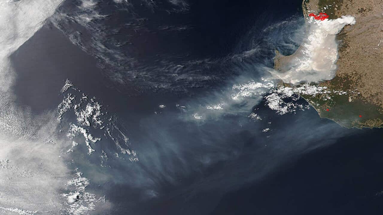
Smoke produced from the deadly bushfires in Western Australia's South West can be seen clearly from space, with a NASA satellite capturing an image of smoke billowing into the Indian and Southern Oceans.

The image was captured by the NASA Suomi NPP satellite on Thursday, with the smoke cloud seen to be stretching hundreds of kilometres into the ocean.

The lightning-sparked bushfire has killed two people and destroyed more than 143 properties in the Shires of Waroona and Harvey, burning through 72,600 hectares.


Share

1 min read

Published

Updated

Source: AAP


Share this with family and friends


Get SBS News daily and direct to your Inbox

Sign up now for the latest news from Australia and around the world direct to your inbox.

By subscribing, you agree to SBS’s terms of service and privacy policy including receiving email updates from SBS.

Download our apps
SBS News
SBS Audio
SBS On Demand

Listen to our podcasts
An overview of the day's top stories from SBS News
Interviews and feature reports from SBS News
Your daily ten minute finance and business news wrap with SBS Finance Editor Ricardo Gonçalves.
A daily five minute news wrap for English learners and people with disability
Get the latest with our News podcasts on your favourite podcast apps.

Watch on SBS
SBS World News

SBS World News

Take a global view with Australia's most comprehensive world news service
Watch the latest news videos from Australia and across the world