The worst of the state's wild weather is yet to come, with heavy rains and thunderstorms expected to lash coastal NSW.
Two severe weather warnings have been issued by the Bureau of Meteorology with heavy rainfall and abnormally high tides forecast for the south coast and heavy rainfall with thunderstorms expected in the mid north coast and Hunter region.
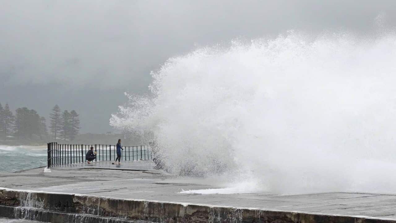
The worst affected region will be the south coast with a deep coastal trough drenching the area and putting it on flood watch from Monday night into Tuesday evening.
"Any locations along coastal parts between today and at least tomorrow evening can receive a sudden downpour," bureau senior forecaster Mohammed Nabi told AAP on Monday.
"The southern coast will be the heaviest hit."
News that makes sense
Your trusted source for staying up-to-date with the world around you. Get free daily news updates and analysis, straight to your inbox.
Water levels on the south coast could reach or exceed the highest tide of the year especially during Tuesday morning.
Rainfalls of 20mm in 20 minutes are likely along the coast and even in Sydney, Mr Nabi says.
An east coast low is forecast to develop across the state's coastal fringe on Tuesday afternoon, but the worst of the weather will be caused by the trough in the lead up to the east coast low.
"The heaviest falls are happening now, tonight and tomorrow morning before it forms," he said.
"The trough does all the hard work and by the time it forms into an (east coast) low, it moves off very quickly."
After a wet commute to work on Monday, Sydneysiders and residents on the south coast can expect a wetter journey on Tuesday.
The wild weather should clear up by Wednesday, with a few showers forecast, but nothing compared to Monday and Tuesday's wet weather.
