


A week of intense rainfall, along with possible flooding, is on the way for much of the east coast of Australia.
The Bureau of Meteorology (BoM) is warning of "a prolonged period of wet and rainy weather" for much east coast this week from south-east Queensland to the Illawarra region south of Sydney. Falls between 50 to 100mm are predicted with rain ramping up on Tuesday, and the most widespread rainfall predicted on Wednesday and Thursday before clearing over the weekend.
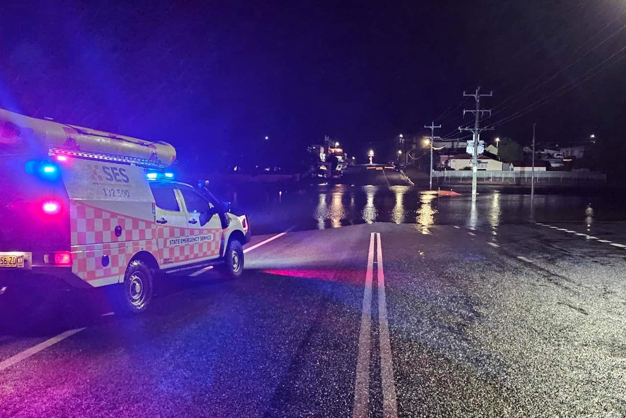
Flood warnings are in place along some parts of the northern rivers, with the NSW State Emergency Service urging northern communities to prepare for possible flooding.
Flood warnings for northern NSW
News that makes sense
Your trusted source for staying up-to-date with the world around you. Get free daily news updates and analysis, straight to your inbox.
Senior meteorologist at the BoM, Dean Narramore, says the areas of most concern for potential flooding are from Coffs Harbour and Grafton through to Port Macquarie.
"Definitely right now our focus is really on the northern rivers, the mid-north and the Hunter, as well as communities in the north-west out towards Tamworth, where we have flood watches and flood warnings current," he told SBS News.
An active flood watch is already in place for the Namoi and Barwon Rivers in north-west NSW.
"In inland areas, so the Namoi and the Peel River, we've already got minor flooding going on right now and so additional rainfall in these areas will lead to renewed rises around the rivers of Hastings, Macleay and the Coffs Harbour areas."
The NSW State Emergency Service (SES) is warning residents in these catchments to understand their flood risks and have an emergency plan in place. Assistant commissioner Colin Malone says that even though there is uncertainty around where the heaviest rain might hit, it won't take much for some areas to experience flash flooding or renewed riverine rises.
"We know that catchments in northern NSW are saturated from recent weather events and will respond quickly to this rainfall," he said.
"Thunderstorms could also cause localised heavy falls, bringing a risk of flash flooding."
The BoM and the SES advise anybody impacted by flooding not to drive, walk, swim or play in floodwaters and to stay away from flooded areas.
More rain on the way for Sydney
The average August rainfall for Sydney is typically 80mm, but the city has already experienced 215mm of rain this month with more on the way this week.
"By the end of this week you could easily see a monthly total of over 300mm for Sydney," Narramore said.
As of Monday afternoon, Sydney is forecast to receive a maximum rainfall of 25mm on Tuesday, 45mm on Wednesday and 35mm on Thursday. Rain is set to ease slightly on Friday, before clearing over the weekend.
However, Narramore says it will be a brief reprieve with another weather system potentially on the way next week.
"We're a bit stuck in this weather pattern," he said.
"Unfortunately, if you don't like wet and rainy conditions, we're likely to continue this weather pattern. And not just in Sydney but right across eastern Australia throughout September, October and November, we're looking at above average rain."
Coldest night of the year
On Sunday night, a dry polar airmass over southeastern Australia, combined with clear skies, resulted in the coldest night of the year so far.
Thredbo Top Station recorded a minimum of -13.2C, while Mt Hotham in Victoria recorded -7.6C.
The last time NSW experienced temperatures like this was in 2018. The coldest temperature ever recorded in Australia was at Charlotte Pass in the Snowy Mountains in 1994 which sunk to a chilly -23C.
For the latest from SBS News, download our app and subscribe to our newsletter.
