Coastal communities in central Queensland have escaped the worst of Tropical Cyclone Iris after it fizzled to a category one system on Wednesday.
However, lingering winds and heavy rainfall caused by the erratic low pressure system are expected to continue for at least another week.
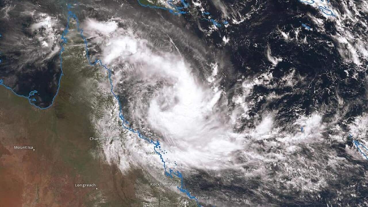
Forecasters had predicted Iris would intensify into a category three system in the early hours of Wednesday.
Instead, it weakened.
Bureau of Meteorology forecaster Jonathan How said conditions could not support a cyclone, and Iris turned away from the coast, dropping to a category one by the afternoon.
News that makes sense
Your trusted source for staying up-to-date with the world around you. Get free daily news updates and analysis, straight to your inbox.
It should turn into a tropical low by nightfall, Mr How said.
It will change direction and begin to track northwest by Friday, with wild weather still predicted.
"Even if Iris does weaken to below tropical cyclone intensity, severe weather could still be experienced along the central coast for the rest of the week," he added.
Iris is about 265 kilometres northeast of Mackay and moving slowly east-southeast at 8km/h.
A cyclone warning remains in place from Bowen to Shoalwater Bay, including Mackay and the Whitsunday Islands.
Gusts of more than 100km/h are starting to ease around the Whitsundays, but could redevelop if it begins to track further south than expected.
