Indonesian authorities have widened the exclusion zone around a volcano that triggered a devastating tsunami in Sumatra and Java.
The volcanology agency raised the Anak Krakatoa volcano's alert status to the second highest and more than doubled the exclusion zone to a 5km radius.
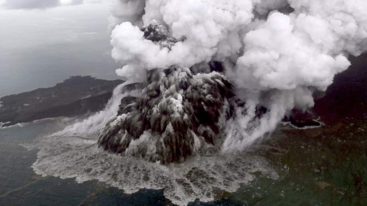
The eruption on Saturday evening caused part of the island in the Sunda Strait to collapse into the sea, generating tsunami waves of more than two metres which left at least 430 people dead.
News that makes sense
Your trusted source for staying up-to-date with the world around you. Get free daily news updates and analysis, straight to your inbox.
The government has warned Sunda Strait communities to stay a kilometre away from the coastline because of the risk of another tsunami.
The disaster struck without warning, taking people by surprise in a country that regularly suffers landslides, earthquakes and volcanic eruptions.
No earthquake shook the ground beforehand, and the waves surged inland at night on a holiday weekend while people were enjoying concerts and other beach and resort activities.
Heavy rains and high seas have hampered the search effort. Some bodies were found at sea and at least 159 people are missing.
Radar data from satellites, converted into images, shows the Anak Krakatoa volcano is dramatically smaller following Saturday's eruption.
Satellite photos are not available because of cloud cover but radar images from a Japan Aerospace Exploration Agency satellite taken before and after the eruption show the volcano's southwestern flank has disappeared.
Dave Petley, head of research and innovation at Sheffield University who analysed similar images from a European Space Agency satellite, said they support the theory that a landslide, most of it undersea, caused the tsunami.
"The challenge now is to interpret what might be happening on the volcano, and what might happen next," he said.
Anak Krakatoa, which means child of Krakatoa, is the offspring of the infamous Krakatoa volcano that affected global climate with a massive eruption in 1883.
Anak Krakatoa first rose above sea level in 1929, according to Indonesia's volcanology agency, and has been increasing its land mass since then.