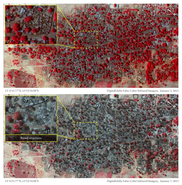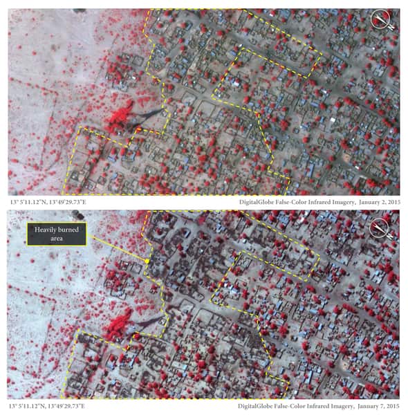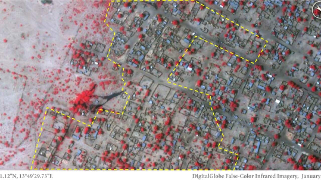
Satellite images show widespread destruction in two Nigerian towns that were recently attacked by Islamic extremists, an international human rights group says.
Amnesty International has released detailed images of Baga and Doron Baga, taken before and after the attack earlier this month, that show more than 3,700 structures were damaged or completely destroyed.
The images were taken January 2 and January 7, Amnesty International said. Boko Haram fighters seized a military base in Baga on January 3 and, according to witnesses, killed hundreds civilians in the ensuing days.
Amnesty International said interviews with witnesses as well as local government officials and human rights activists suggest hundreds of civilians were shot; last week, the human rights group noted reports of as many as 2,000 dead. The Nigerian military has cited a figure of 150 dead, including slain militants.
Nigeria's home-grown Boko Haram group drew international condemnation when its fighters kidnapped 276 schoolgirls from a boarding school in northeast Chibok town last year. Dozens escaped but 219 remain missing.
News that makes sense
Your trusted source for staying up-to-date with the world around you. Get free daily news updates and analysis, straight to your inbox.