

Tropical cyclone Narelle, upgraded to a category 4 storm on Thursday, is north of Exmouth in Western Australia and may reach maximum storm strength as it skirts a series of isolated coastal communities.
The cyclone is turning south and is expected to pass close to the North West Cape this morning, according to the Bureau of Meteorology at 7am (AWST).
It is producing sustained winds of 185km/h near the centre and gusts of up to 260km/h.
"Narelle is larger than usual and gales may still occur over the central Pilbara coast," the bureau said on Friday.
It said a severe weather warning for damaging wind gusts east of Whim Creek and for inland parts of the Pilbara has been issued.
News that makes sense
Your trusted source for staying up-to-date with the world around you. Get free daily news updates and analysis, straight to your inbox.
The western Pilbara coast to the Gascoyne coast will be affected this morning before the cyclone heads south to Carnarvon and Denham.
The cyclone is however expected to weaken on Saturday, according to the BoM.
Tourists have been told to leave the region, major roads have been closed, and evacuation centres have been set up ahead of Narelle's arrival.
Meteorologist James Ashley said on Friday Narelle was an unusual and large storm.
"The system is packing winds well over 200km/h at the moment, and all those coastal places between Exmouth and Shark Bay can expect those severe wind impacts as well as that heavy rainfall," he said.
Some locations could receive more than 200mm of rainfall and flash flooding, with significant storm surges possible.
Shark Bay shire president Peter Stubberfield said volunteers had been busy sandbagging ahead of a possible tidal surge in the tiny holiday town of Denham on the Peron Peninsula, 830km north of Perth.
"We're preparing for the worst ... and we're hoping for anything less than that," he said.
Tackle shop manager Barry Taylor said Exmouth residents had worked hard "getting everything as locked down or strapped up and as safe as we can" ahead of Narelle's arrival.
"Fingers crossed we don't cop it too hard," he said.
The town of about 3000 people was devastated when the category five Tropical Cyclone Vance slammed into it on March 22, 1999.
"You've got a lot of people in this town that went through Vance," he said.
They're the ones probably most wary - quite a few that haven't seen a decent cyclone either."
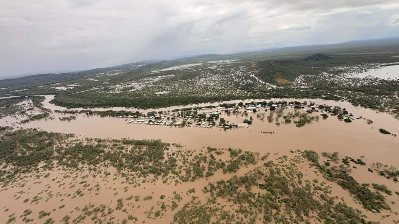
Narelle's epic journey across northern Australia began when it first crossed the coast in Queensland as a category four system on Friday, moving over the Cape York Peninsula.
It left a trail of power outages and flooding as it hit the NT as a category three by Sunday, forcing hundreds of people to evacuate.
After initially crossing northern WA as a tropical low on Monday, Narelle has gained strength in the Indian Ocean, heading southwest along the Pilbara coastline.
For the latest from SBS News, download our app and subscribe to our newsletter.
