


The decision to move the search so far from the Malaysia Airlines route between Kuala Lumpur and Beijing was driven by just eight brief contacts between the aircraft and an Inmarsat communications satellite.
Those contacts came after the plane’s normal communications system somehow stopped operating during the flight last March.
That left investigators to approximate its final position from the small amount of data available, including how far it could possibly have flown with the amount of fuel on board.
In a special report MH370 One Year On, Dateline looks at the latest on the search to find the plane in one of the deepest, most remote and unexplored areas of the world.
News that makes sense
Your trusted source for staying up-to-date with the world around you. Get free daily news updates and analysis, straight to your inbox.
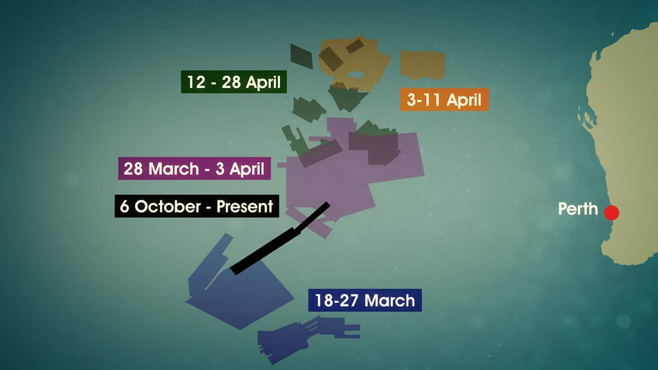
The map of the search area in the Southern Indian Ocean shows the scale – from the initial aerial and surface search last March up to the current underwater mission.
That detailed sonar search is covering a priority area of 60,000 square kilometres, which is about two thirds the size of Tasmania. Around 40% of it has been covered so far.
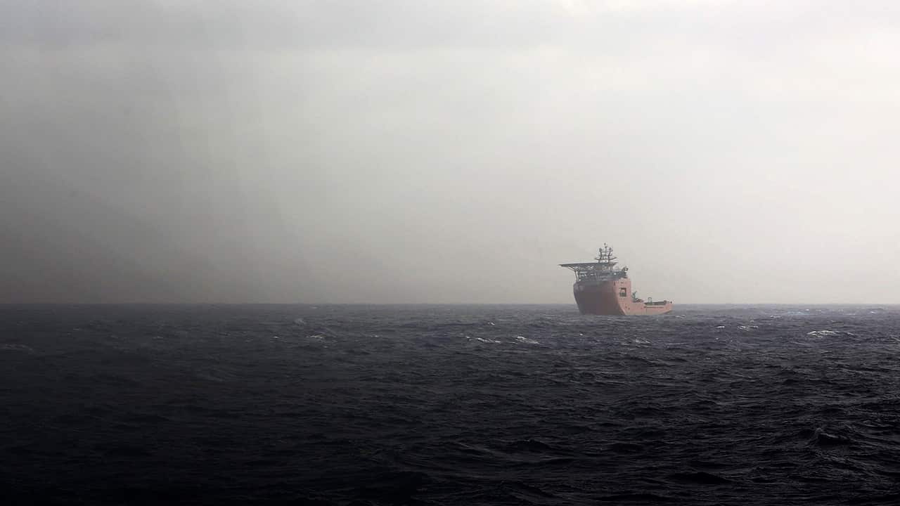
Four search boats carrying a team of around 180 people are working 24/7 towing a 900 kilogram scanner at walking speed to get the clearest possible view of the sea floor.
Any promising images from the search are not only analysed by computer, but are checked by at least 12 sets of human eyes for any evidence of the plane.
The images of the search area are rendered at a resolution of one metre per pixel, but can be magnified to 10 centimetres on particular areas of interest.
“I think at last count there’s 220 people involved,” Peter Foley from the Australian Transport Safety Bureau tells Dateline.
“Lots of folks are doing work for us free of charge, they’re doing it because they believe in what we’re doing… we can’t leave this a mystery.”
A video put together by Geoscience Australia shows the physical challenges facing the search team.
Not only are the seas rough in this remote area 1,800 kilometres off the WA coast, but the ocean floor has very uneven terrain and is over six kilometres deep in places.
“There’s lots of geological features - lumps, bumps, some volcanoes,” says Steve Duffield from Fugro Offshore Survey, which is providing three of the vessels involved in the search.
“One rift to the south was 250 kilometres long with a wall 1,000 metres high,” he says, demonstrating the challenge to keep the scanner 100 and 150 metres from the ocean floor.
“The hardest part is that they’re six days away from the port of Fremantle to the work site,” Steve adds. “So it’s a big sail away - they’re a long way from home. It’s 42 days before they come back to Fremantle.”
The Australian and Malaysian Governments are contributing equally at up to $60 million each for the underwater search. Australia has committed up to $89.9 million in total. It's the most expensive search and rescue in history.
“We’re determined to put in the maximum, the best possible effort, and if the aircraft is where we think it is, we’re confident we can find it,” Deputy Prime Minister Warren Truss tells Dateline.
“[It’s] been frustrating, but particularly frustrating obviously for the families, who are seeking information, so that they can have some closure in this incident,” he says.
The current stage is expected to finish by May, but Warren Truss has already said that the search won’t be able to continue forever.
Experts say the only comparable incident to the MH370 search is the loss of Air France flight 447 in the Atlantic Ocean in 2009.
In that case, the approximate location was known and wreckage was found within a week, but it took almost two years to recover the plane’s black boxes from a depth of around four kilometres.
Dateline is an award-winning Australian, international documentary series airing for over 40 years. Each week Dateline scours the globe to bring you a world of daring stories. Read more about Dateline
Have a story or comment? Contact Us
