
That's a wrap for today
We're ending our live coverage of Tropical Cyclone Narelle. Here's the latest as we close out the blog for the day.
- Tropical Cyclone Narelle is continuing to track west across the Cape York Peninsula as a serious category 3 system after making landfall on the Queensland coast as a dangerous category 4 storm, producing wind gusts of more than 250 km/h.
- Queensland premier David Crisafulli said initial reports indicated there had been relatively minimal damage in Coen, after the storm passed between the town and Lockhart River
- The premier said the major challenge now is flooding amid significant rainfall in the Cape York region
- Queensland police said there had been no reports of fatalities or serious injuries
- Northern Territory communities are preparing as the storm may intensify over water before making landfall there on Saturday
- Flood watches have been issued across the Top End, with heavy rain expected and waterways expected to rise
No reports of significant damage in Coen so far, police say
The Queensland Police Service (QPS) said there had been no reports so far of significant infrastructure damage or injuries in Coen, which was expected to be hit hard by the storm.
Robyn Holmes, the mayor for Cook Shire Council which governs Coen, said there would be water restrictions in place in the coming days, ABC reported.
However, she said the situation in the afternoon had been more relaxed than in the morning, with damage less significant than what had been expected.
She also said the town was still on alert for flooding, as rivers has been rising rapidly.
— Wing Kuang
First Nations community in cyclone's path braces
On the island of Groote Eylandt off the east coast of the Northern Territory, a First Nations community is preparing for the arrival of the Tropical Cyclone Narelle, which is expected to intensify later after being downgraded to a category 3 system.
Kupa Teao, the chief executive of Anindilyakwa Land Council, said many resources have been directed into preparing for the cyclone, but there’s still "a sense of uncertainty" within the community.
"No one knows what’s going to happen when the storm suddenly hits the island," he told SBS News.
"I guess probably the best way to respond is that we better prepare ourselves, making sure … everyone's across everything, emergency services, all the local stakeholders."
Groote Eylandt is in the path of Cyclone Narelle as it crosses Cape York Peninsula and heads westward.
Teao said the Anindilyakwa Land Council has been in close contact with the Northern Territory government and police over the preparations as well as communication with local stakeholders.
"I have confidence in their management of the whole thing," he said.
— Josh van Staden, Wing Kuang
Tropical Cyclone Narelle has been downgraded to a category 3 System
Tropical Cyclone Narelle has been downgraded from category 4 to category 3 and is now heading west, as it crosses Cape York Peninsula and brings heavy rainfall.
Queensland Premier David Crisafulli said the winds were moving "in a reasonably quick pace" and the wind would intensify once it hit the waters on the west side of Cape York Peninsula.
"Our message to people is to stay in place," he told the ABC.
He also said police have been on the ground to assist locals, and praised many residents who "did the right thing".
Crisafulli said they have also received early reports of property damage in Coen, a small town in far north Queensland that had been expected to be hit hard by the storm.
He said emergency services, police and medical staff were on the ground and ready to step in to help.
— Wing Kuang
Major flood warning issued for Katherine, with NT next in line to face tropical cyclone Narelle
Northern Territory Deputy Chief Minister Gerard Maley has warned that Tropical Cyclone Narelle will slam into the NT coast as a category three or four storm after hitting far north Queensland.
The result is significant flooding across the territory.
A major flood warning has been issued for Katherine and a field hospital is also being set up in the town.
The Bureau of Meteorology says an already "very saturated" Katherine River will be "very responsive to rainfall".
"We can see that when we have rain, the river responds very quickly, jumping up and then dropping quite quickly," a BoM spokeswoman said during a press conference in Darwin on Friday afternoon.
"This means that the catchment is saturated. It means that any rain that happens in and around Katherine will cause flooding."
Major flooding is also possible at Nitmiluk Centre and at Katherine Bridge from Friday night. The Katherine township will be affected from Monday morning, the BoM says.
Elsewhere in the Northern Territory, the coastal communities on the east coast closest to far north Queensland will experience "category 2" impacts from Saturday night into Sunday morning.
Wind gusts are expected at around 160km/h and tides will be higher than usual bringing large waves. There will also heavy rainfall of between 150 to 200 millimetres which can cause flash flooding. These conditions should ease on Sunday.
The cyclone is expected to turn into a tropical low as it moves west.
The New South Wales State Emergency Service (SES) has sent 60 people to help in the NT.
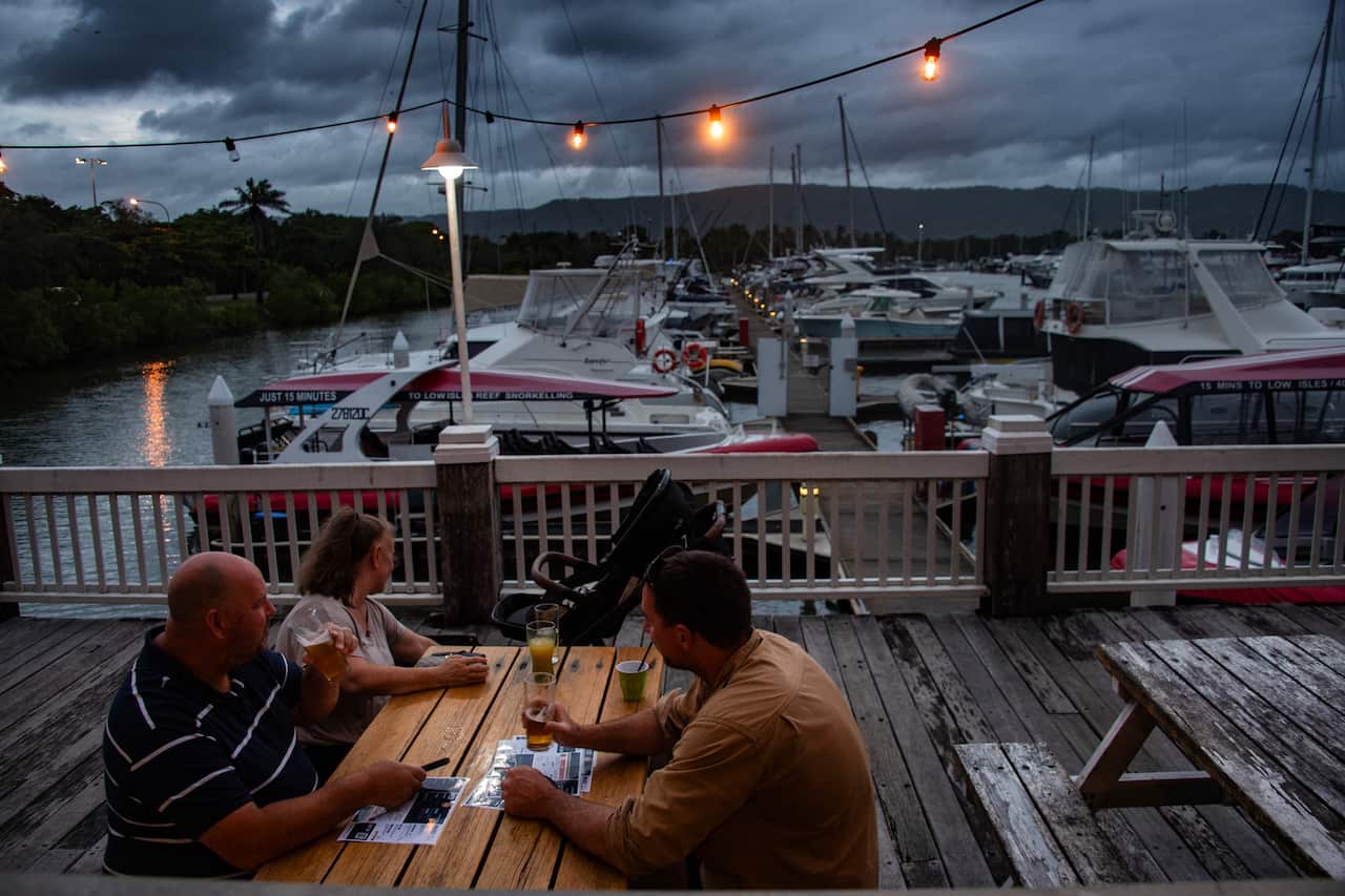
In pictures: Awaiting Cyclone Narelle's arrival
In Port Douglas, a town on the coast of the Coral Sea that serves as a gateway to Cape York Peninsula, some residents have also experienced power outages as the town braced for heavy rainfall overnight.
Here are some photos of the locals awaiting the cyclone, taken before it arrived.
— Australia Associated Press
'It's just howling': residents
Lockhart Mayor Wayne Butcher said residents were hunkering down to wait out tropical cyclone Narelle's fury.
"It is just howling here at the moment," Butcher said.
"The winds are coming from the west and it is gale force. The trees are whistling and swaying side to side. Everyone is in and locked down and now we just have to weather the storm.
"I think it's crossing the coast right now. It's closer to Coen, but things are really bad here."
Local resident Ben Chuckie uploaded a video showing conditions in Weipa this morning, 260km north of Coen where the cyclone first made landfall.
Tropical Cyclone has lashed the Queensland coast with wind speeds of more than 200km/h: BoM
The Bureau of Meteorology confirmed Tropical Cyclone Narelle touched down at 7am Queensland time on Friday while Lockhart River, Coen, and Port Stewart residents have been warned to take immediate shelter.
Wind speeds near the centre of the cyclone have hit 195km/h, with wind gusts reaching 270km/h.
Cyclone Narelle is now moving westward and is crossing the area between Lockhart River and Coen.
Senior meteorologist Sarah Scully warned the system would cause large airborne debris, major structural damage, and property destruction.
"Satellite data is indicating that there's widespread winds near the centre of the system, well in excess of 200 km/h," she said.
"Very destructive winds may start to be experienced within the next hour ahead of the coastal crossing. Winds of this strength have the potential to cause significant structural damage to buildings and property, such as significant loss of roofs."
Emergency alerts have been issued urging residents in the remote communities of Lockhart River, Coen, and Port Stewart to take immediate shelter.
"Take shelter now in the strongest part of the building you are in," the warning said.
Narelle was on course to be the first category five system to hit Cape York since Cyclone Mahina killed more than 300 people in March 1899. It was downgraded to category 4 on Friday morning.
— Wing Kuang, AAP
'The prospect of flash flooding is real': Premier urges Queenslanders to stay alert
Queensland Premier David Crisafulli has warned there will be flash flooding and potential long-term power outages, as the state's far north is set to experience the category-four Tropical Cyclone Narelle today.
"There's a lot of rain in the system. And as it moves, it will be hard and fast, and we are dealing with the area where there are already very saturated catchments," Crisafulli said.
"As a result, the prospect of flash flooding is real, and people in Far North Queensland understand where those high-risk areas are."
He said around 300 power outages have been recorded so far, with 73 of them in Coen, a remote town of around 320 people where Cyclone Narelle is heading towards.

Crisafulli said there may be long-term power outages due to the cyclone's intensity.
He added that health facilities have been adequately staffed, and 14 schools in the area have been closed. Police are making their final door-knocks in the area today to ensure residents are safe.
"My message to Queenslanders is this: we have prepared, you have prepared, the best place right now is that you remain exactly where you are," he said.
— Wing Kuang
'Winds are strong enough to strip and uproot entire trees': Bureau of Meteorology
The Bureau of Meteorology has provided a quick update on Tropical Cyclone Narelle as it crossed far north Queensland this morning.
— Bureau of Meteorology
Welcome to today's live blog
Good morning and welcome to today's live blog covering Tropical Cyclone Narelle, which has made landfall in far north Queensland this morning.
Here's what you need to know so far.
- Residents are urged to take immediate shelter as Tropical Cyclone Narelle brings very destructive winds of more than 270km/h near its centre as it crosses Queensland's Cape York Peninsula on Friday morning.
- Emergency alerts have been issued urging residents in the remote communities of Lockhart River, Coen, and Port Stewart to take immediate shelter. "Take shelter now in the strongest part of the building you are in," the warning said.
- After intensifying in the Coral Sea to a peak category five system on Thursday, the Bureau of Meteorology confirmed the system had been downgraded early Friday, but warned conditions remained very dangerous.
- Meteorologist Angus Hines said on Thursday afternoon that Narelle was an extremely powerful weather system. "They do not get more powerful than this." It's been described as one of the most powerful storms in living memory.
Read more here:
— Australian Associated Press
