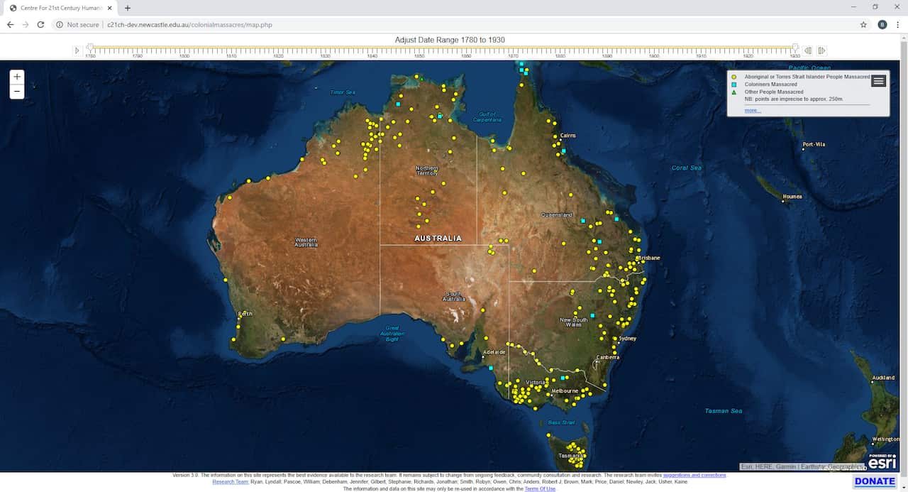
The latest updates to a digit map that tracks the extent of frontier violence was launched on Monday, with the Western Australia Kimberley district featuring heavily in the 53 additional sites confirmed.
Stage 3 of the map, titled Colonial Frontier Massacres in Australia 1788-1930, has also incorporated newly researched massacre sites in the Northern Territory and South Australia.
Professor Lyndall Ryan, who leads the project’s research team at the University of Newcastle, said the researchers hoped the map would change the way the nation understands its colonial history.
“In the past there has been a denial of the violence that took place , and Australia’s true history has largely been invisible,” said Prof Ryan.
The research now reveals that at least around 8400 people were killed during 311 massacres that took place between 1788 and 1930.
About 97 per cent of those killed were First Nations men, women and children.
Stage 3 of the digital map project added 41 massacre sites in WA and 9 more in the NT.
Earlier this year, Guardian Australia collaborated with the researchers to bring the data to international prominence with The Killing Times web project.
With the release of the Stage 3 research on Monday, Prof Ryan told Guardian Australia the data also revealed that the massacres became more violent and strategic over time and followed a pattern as the colonial frontier expanded.
“Just about all of the massacres in the first 30 years [of invasion] are carried out by government forces,” Prof Ryan told the Guardian. “There’s always police involved int he story, right across Australia.”
In a media release on Monday, the research team said the data revealed distinct patterns around the locations of massacres, with the bulk of atrocities occurring along major rivers and the route of the Overland Telegraph as colonial forces cleared the way for settlers to spread out across Australia.
The research team sourced data from the diaries of settlers, testimony from survivors and newspapers to corroborate the well-known oral histories of First Nations people. These sources revealed the inhumane attitude settlers and police had towards Aboriginal people, said Prof Ryan.
Prof Ryan said the researchers hoped the map would change the way the nation understands its colonial history.
“What we hope our research can achieve is to put a spotlight on the truth, to bring about historical acceptance and in doing so hopefully we can contribute to a path towards reconciliation.”