


The Cyclone Warning and Watch areas for the NT have been cancelled but a Severe Weather Warning continues.
The Tropical Low is located over the Cobourg Peninsula close to Cape Don. It is expected to move towards the southwest, passing over the Tiwi islands overnight. Although the low may develop into a Tropical Cyclone in the Timor Sea on Wednesday, direct impacts from a tropical cyclone are not expected on the NT coast.
The Tropical Cyclone is forecast to strengthen over the Timor Sea and approach the north Kimberley coast as a category two cyclone during Thursday.
The community is already experiencing heavy rains and strong winds, which are due to intensify to around 100 kilometres per hour when the system forms.
Dangerous flooding, damaging waves and gales with gusts of up to 110 kilometers per hour are expected in the Tiwi Islands, where around 3100 people live.
Northern Territory Police, Fire and Emergency Services has advised residents to ready their emergency kits, take shelter in strong buildings and restrict any unnecessary travel.
"Clear your premises of potential wind-borne missiles," the NTPFES said.
"Don't go outside until advised it is safe to do so."
Authorities say the Tiwi locals are well prepared, with hundreds picking up essential items overnight at supermarkets in Wurrimiyanga, one of the largest communities on Bathurst Island.
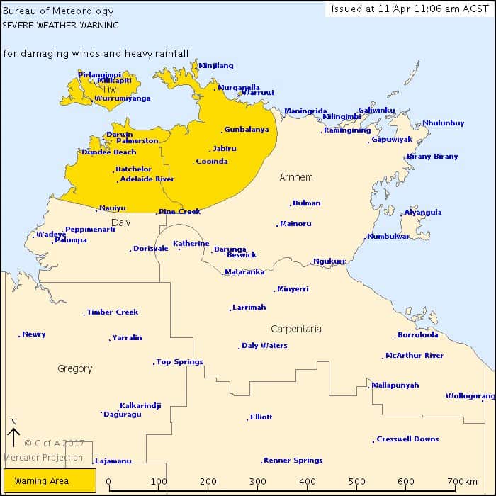
The Tiwi and northwest Arnhem Districts are forecast to be drenched by rainfalls totals of up to 150mm on Tuesday night, which should extend into the northern Daly district including Darwin on Wednesday.
NTPFES Commander Tony Fuller advised Top End motorists to use caution as the risk of flash flooding increases.
"This serves as a reminder to drivers, 'if it's flooded, forget it'," he said.
"Do not attempt to enter or cross flooded roads and stay away from swollen waterways including pipes and drains."
